Vasstech Guide to GPS & Navigation
Having a vehicle is all well and good, but arriving at your destination quickly and directly is key to any successful journey – the days of plotting a route on an A to Z before any long trip are long gone. Instead, most people rely on some form of GPS, whether that’s on their phone or a purpose-built sat-nav, to get them to where they need to be.
With so many options on the market, it can be challenging to know which is best for you and worth spending your money on. Fortunately, if you own a mobile phone, many options are free, and today it’s not uncommon to see cars with an onboard GPS. While maps will literally point you in the right direction, our guide will be able to direct you to the best option for you.
What types of navigation are available?
The most common tools used for planning journeys are dedicated systems purchased as separate pieces of equipment, known as a sat-nav or built into the car’s dashboard, often sold as an add-on purchase. For those who don’t want the extra gear or to purchase the add-on, a modern mobile phone will usually suffice, though both have pros and cons.
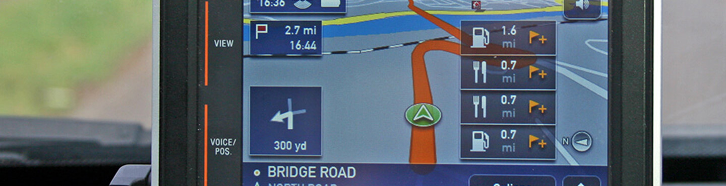
Dedicated Sat-Nav’s
Generally speaking, dedicated car sat-navs provide a more sophisticated navigation system with better traffic information features when compared to smartphone apps. While a reliable sat-nav may cost an initial £100+, and built-in sat-navs can be even more costly, especially when compared to a smartphone’s app price of £0, a sat-nav doesn’t require any further costs, such as a data plan.
Similarly, a smartphone may run out of space due to the mapping system sharing the same hard drive as the owner’s photo album, music playlists and a whole host of other applications; a sat-nav doesn’t have to worry about memory space being taken up in the same way.
The design of a purpose-built sat-nav is also easier to use than a phone, especially when in a car. With larger screens, built-in systems designed for use on the go and a clearer audio system that, with a built-in sat-nav, automatically plays through the car’s audio system. A built-in system has the additional benefit of convenience and doesn’t require you to think about charging your device or removing it from your dashboard.
It’s worth noting that many of today’s cars come with sat-navs as standard. You can expect to find them in mid-range versions of mainstream cars such as the Volkswagen Golf or as part of an option pack that includes other tools. Premium models will almost certainly come with a built-in sat-nav and have become expected as part of the package.
How much do built-in sat-navs cost?
The price of a built-in sat-nav can vary massively depending on the make and model of the car. Ranging from a few hundred pounds to £1000, higher-end models are often included as part of multimedia systems, driving the price up.
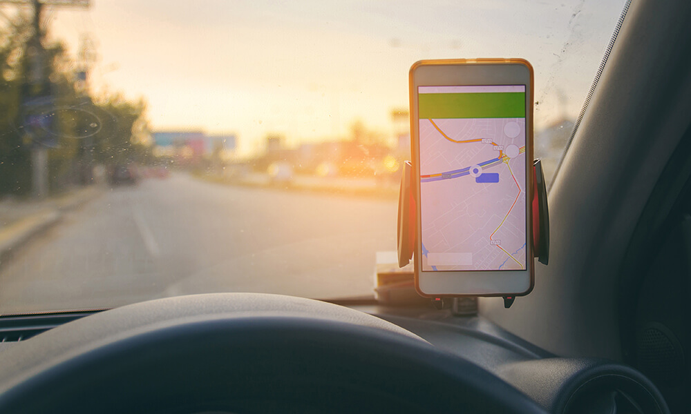
Smartphones
These days smartphones are ubiquitous; it’s rare to see someone with a phone without GPS functions that can’t run map software. In fact, almost all phones today will come with a navigation app.
If you have sufficient space on your phone and an updated application, you can use your phone much the same way you would an inbuilt sat-nav. Depending on where you are in the country, you might even find that your smartphone is better suited to the job, as it can use local cell towers to improve its GPS signal.
While many apps involve an offline mapping function that doesn’t require you to use your data, if you choose to remain connected to the internet, you’ll be able to receive live updates on traffic and route options. Unless you factor in the costs of the smartphone and data plan, the price of navigating by phone is next to nothing.
How do I connect my mobile phone to my car?
Connecting your phone to your car is relatively simple, but before you try, make sure both can connect to one another. Once you know Bluetooth pairing is possible, it’s simply a process of navigating to the Bluetooth pairing option on your car’s stereo and then finding the Bluetooth setting menu on your phone.
You should be able to select your car’s stereo once your phone searches for available devices. After doing so, you may be presented with a PIN request; the number can be typically found on the screen of your car’s stereo.
Once connected, you should be able to play your phone’s media through your phone, including map navigation signals.
Best smartphone map for driving directions
Today, there’s a wide range of navigation apps available at the press of a button, most of which are free. Those that aren’t may try to sell you additional features may display adverts while in use or may very well collect your data to then sell to advertisers. If you don’t like the sound of any of these caveats, you may have to pay for a map. But for now, we’ve covered a breadth of the market to present you with the most popular map options out there.
It’s worth reminding yourself that using your phone while driving is against the law, and at Vasstech we certainly don’t condone the use of mobile phones when on the road. If you choose to use your phone for directions, you should select your destination and start the navigation prior to setting off.
If you want to change or adjust your destination or change your phone settings, you should make sure you’re safely parked with the vehicle’s engine off.
Google Maps
Google’s database and wide-reaching internet coverage allow them to create a navigation app that updates in real-time and offers valuable information to road users, such as speed camera functionality, mobile speed camera locations and car crashes (only available on android). Using data from the various users in an area can give you an accurate insight into the business of the road ahead. Not only this, but Google Maps integration with the primary search engine function allows it to present information on companies and addresses.
TomTom GO
One of the few apps to charge you to download, TomTom GO may cost £19.99 but offers a stellar navigation experience. One downside, however, is the need to download the map of an area before you start, which could cause problems if your phone is already tight on space. That said, the app continues to work well even in areas that have low reception, allowing you to continue to use the precise mapping and speed-camera locator.
Waze
Popular among taxi drivers for its ability to measure traffic flow and the function that allows users to report issues to other people who use the app. The app is useful for its ability to play music and podcasts, which reduces the need to flick between different apps, which can be handy when out on the road. With a peculiar penchant for minor roads over major ones when faced with small amounts of traffic, Waze provides a smooth but sometimes extended journey, albeit for free.